The laboratory was established in 2022 to conduct research in ecology and geography. In its approaches, the team merges experimental methods of ground-based measurements of ecosystem functioning with the math-based methods of remote sensing (RS) data processing.
The main goal is to develop a set of approaches for RS data processing that will allow to use them most effectively as a source of information about landscape structure and organisation. Thereby, the key research focus of the lab is to develop methods for:
News
The conference aims to advance landscape ecology as a scientific basis for territorial management under conditions of global change and increasing natural and climate‑related risks. The purpose of the conference is to analyze and discuss the current state and future prospects of landscape ecology in Russia and worldwide, to consider modern methodological approaches and empirical findings, and to create a scientific platform for exchange of experience and development of national and international research cooperation. Special attention will be paid to applied aspects of landscape ecology and their use in environmental and spatial planning, climate change adaptation, and natural risk management.

The neural network analysed nearly a million 12×12 m plots and found that the rate of shrub spread varies from 2.4% to 26.1% per decade, depending on local conditions. The study showed that mature shrubs prefer well-drained slopes, while new colonisation occurs on flatter areas, which opens up opportunities for predicting further shrubification of the Arctic under climate change conditions

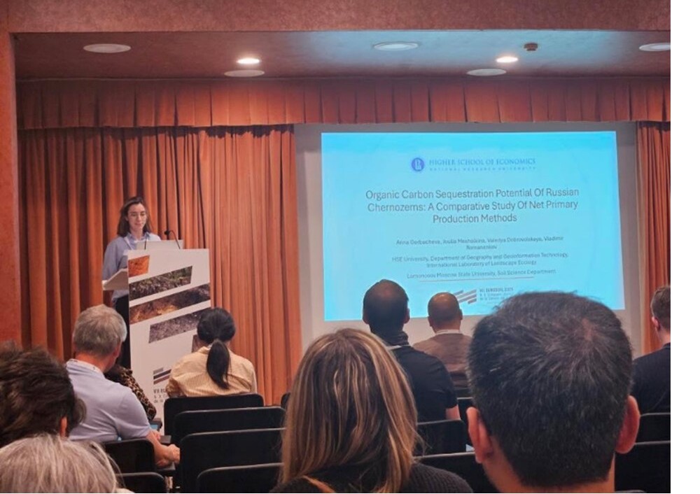
From 8 to 12 September 2025, the 7th EUROSOIL Congress took place in Seville, Spain, bringing together more than 1,000 soil scientists from 63 countries under the topic “Advancing Soil Knowledge for a Sustainable Future.” The congress opened with a series of keynote lectures by leading global experts. Nobel Peace Prize laureate Professor Rattan Lal highlighted the pivotal role of soil in the 21st century; Panos Panagos (Joint Research Centre, European Commission) discussed challenges and opportunities for soil science and policy as well as presented the new Soil Monitoring and Resilience Law; Claire Chenu (INRAE) delivered a lecture on soil carbon science for EU policy. Heike Knicker explored the biochemical effects of biochar; Manuel Delgado-Baquerizo spoke about soil biodiversity under global change; Laura B. Reyes Sánchez addressed soil science education; and Peter Schad discussed the future of international soil classification.

The key topics of the conference were:
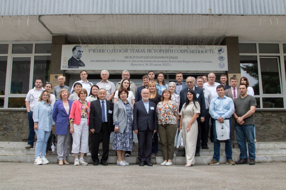
1) Viktor Borisovich Sochava – geographer, geobotanist, cartographer, educator, science organiser, memories of Academician V.B. Sochava;
2) the theory of geosystems as a theoretical and methodological basis for the development of the concept of human co-creation with nature;
3) the theory and methodology of geobotanical mapping and regionalisation;
4) mapping and geoinformation modelling of geosystems for the purposes of planning rational nature management. A total of 45 reports were presented at the conference, devoted not only to the theoretical and methodological aspects of the development of the teachings of V.B. Sochava and his followers on geosystems, but also on modern methods of mapping and modelling geosystems and their individual components based on GIS and remote sensing, as well as the applied use of research results for the organisation of rational nature management.
On May 15, the International Laboratory for Population and Health, in collaboration with the International Laboratory of Landscape Ecology, held a seminar on “Air temperature and population health in Russian cities: results of the first national study, 2000–2019.”The seminar featured presentations by Sergey Timonin, a research fellow at the Australian National University, and Natalia Shartova, a postdoctoral researcher at the Barcelona Institute for Global Health.

The key areas of the conference this year were modeling the processes of growth and development of living organisms, the dynamics of populations and communities; modeling of ecological complexity, statistical and spatial modeling; modeling of element cycles and matter flows in ecosystems, including at the regional and global levels; mathematical models in soil science and landscape science; mathematical models as a tool for supporting decision-making in problems of managing biological resources, solving climate change problems and rational nature management.
On December 19, 2024, the eighth and final seminar "Dynamics of environmental management, climate and biological productivity of landscapes of Buryatia and Tuva in the late twentieth and early twenty-first centuries" was held
At a seminar held on December 12, 2024, P.M.Shilov, Candidate of Biological Sciences, M.Sc., V.V.Dokuchaev Soil Institute, spoke about the problems of development and promising growth points in soil geophysics.

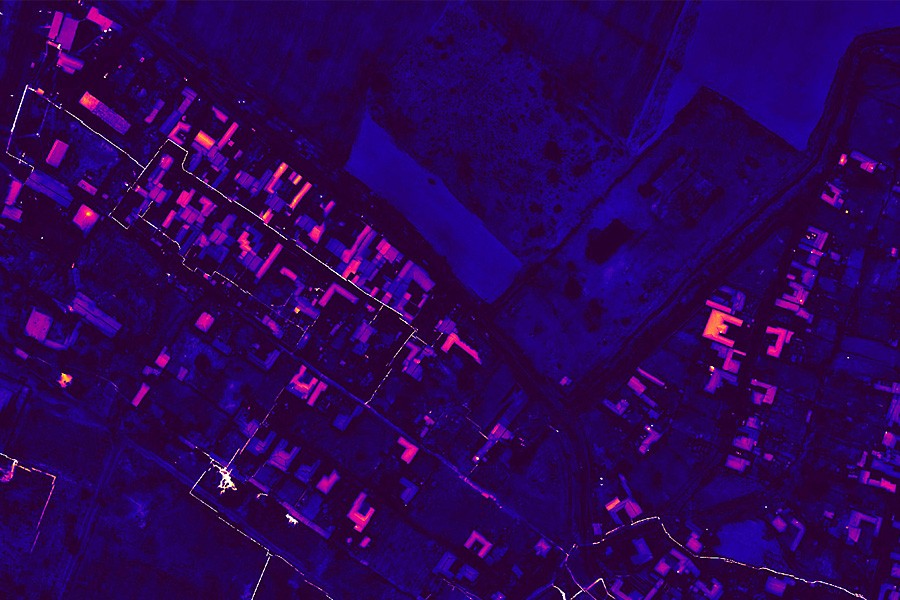
During the event, Andrey Medvedev, Head of the Department of the Institute of Geography of the Russian Academy of Sciences, spoke about the analysis of the temperature of the underlying surface and the identification of objects based on high-detail thermal imaging.
.png)
During the event on December 28, 2024, Alexander Krenke and Mikhail Puzachenko, senior researchers at the Institute of Geography of the Russian Academy of Sciences, spoke about the heterogeneity of the territory on various scales in landscape and climatic zoning.
