The Sixth Seminar of the Autumn Seminar Series of the International Laboratory of Landscape Ecology Took Place
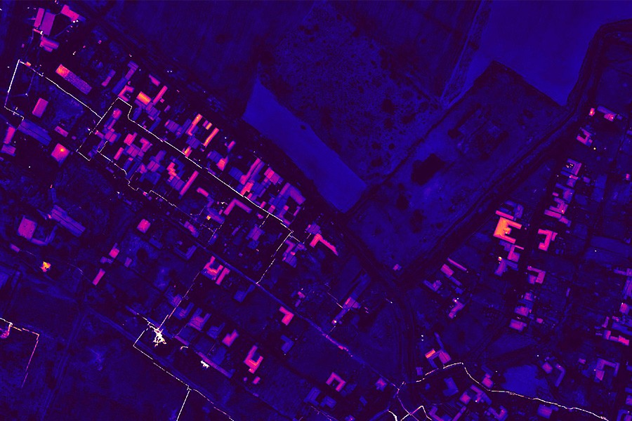
During the event, Andrey Medvedev, Head of the Department of the Institute of Geography of the Russian Academy of Sciences, spoke about the analysis of the temperature of the underlying surface and the identification of objects based on high-detail thermal imaging.

The use of thermal or thermal imaging for the study and monitoring of natural and anthropogenic objects has become an important source of information that allows you to analyze the temperature of the underlying surface and assess the impact on the environment. This method has become widely used for the study of urban areas, infrastructure facilities, thermodynamic characteristics of the landscape, moisture content in soil and vegetation, etc. At the global level, thermal imaging is mainly used to study the atmosphere and water bodies. However, the global thermal infrared data collection contains almost no high- and ultra-high-resolution information, but includes only individual objects and local studies. The report provides an overview of methodological and technological approaches to ultra-high resolution aerial thermal imaging, which opens up new directions for studying natural and anthropogenic objects, and uses examples from various fields to consider what capabilities and limitations the data have.
