- A
- A
- A
- ABC
- ABC
- ABC
- А
- А
- А
- А
- А
- HSE University
- Faculty of Geography and Geoinformation Technology
- News
- The experts highlighted the importance of introducing digital technologies in school geography education
-
Faculty
-
Educational Programmes
Geography of Global Changes and Geoinformation Technology
Spatial Data and Applied Geoanalytics
Low Carbon Development
 Атлас изменений окружающей среды - Кыргызская Республика (Atlas of Environmental Change - Kyrgyz Republic)
Medvedev A., Alekseenko N., Kuramagomedov B. et al.
United Nations Environment Programme, 2025.
Shvidenko A., Ciais P., Patra P. K. et al.
Global Biogeochemical Cycles. 2025. Vol. 39. No. 10. P. 1-38.
In bk.: Reference Module in Earth Systems and Environmental Sciences. Oxford: Elsevier, 2025. P. 1-11.
Колосов В. А., Zotova M.
Published online. 10.1080/14650045.2021.1952184. Taylor and Francis, 2021

The experts highlighted the importance of introducing digital technologies in school geography education
The conference provides teachers with an opportunity to exchange experience and knowledge, discuss topical issues of geography education and share best practices in this field. It is geography teachers who become the first mentors of schoolchildren in environmental issues, they help students to understand environmental problems and ways to solve them.
The conference discussed the introduction of digital technologies into the educational process. Alexey Krylov, Deputy Dean of the Faculty of Geography and Geoinformation Technologies, opened the event. He noted the importance of supporting the professional community of teachers and emphasized that digital technologies open new opportunities for learning, making it more accessible and interesting for students.
Sergey Barinov, Senior Analyst of the Faculty of Geography and organizer of the conference, announced the opening of the Laboratory of Modern School Geography and Local History on the basis of the Faculty of Geography. The mission of the laboratory is to contribute to the improvement of the quality of school geography and local history education, as well as to the popularization of geographical science in Russia. The laboratory will work in several areas: Olympiads and work with Olympiad participants, professional development and forming a professional community, interaction with foreign applicants, as well as consulting schools and expertise of non-profit organizations.
The second speaker was Anna Derkacheva, a researcher at the International Laboratory of Landscape Ecology specializing in cartography, geoinformatics and remotely sensed data. She spoke about the history of remote sensing, its types and how modern methods of obtaining information about the Earth's surface and objects using different types of imaging equipment work. Anna advised teachers to use the Google Earth program so that schoolchildren could interactively explore the Earth's surface themselves. Using the program makes geography lessons more interactive and fun. Google Earth will help students in project work and can become a basis for creating geography-related projects.

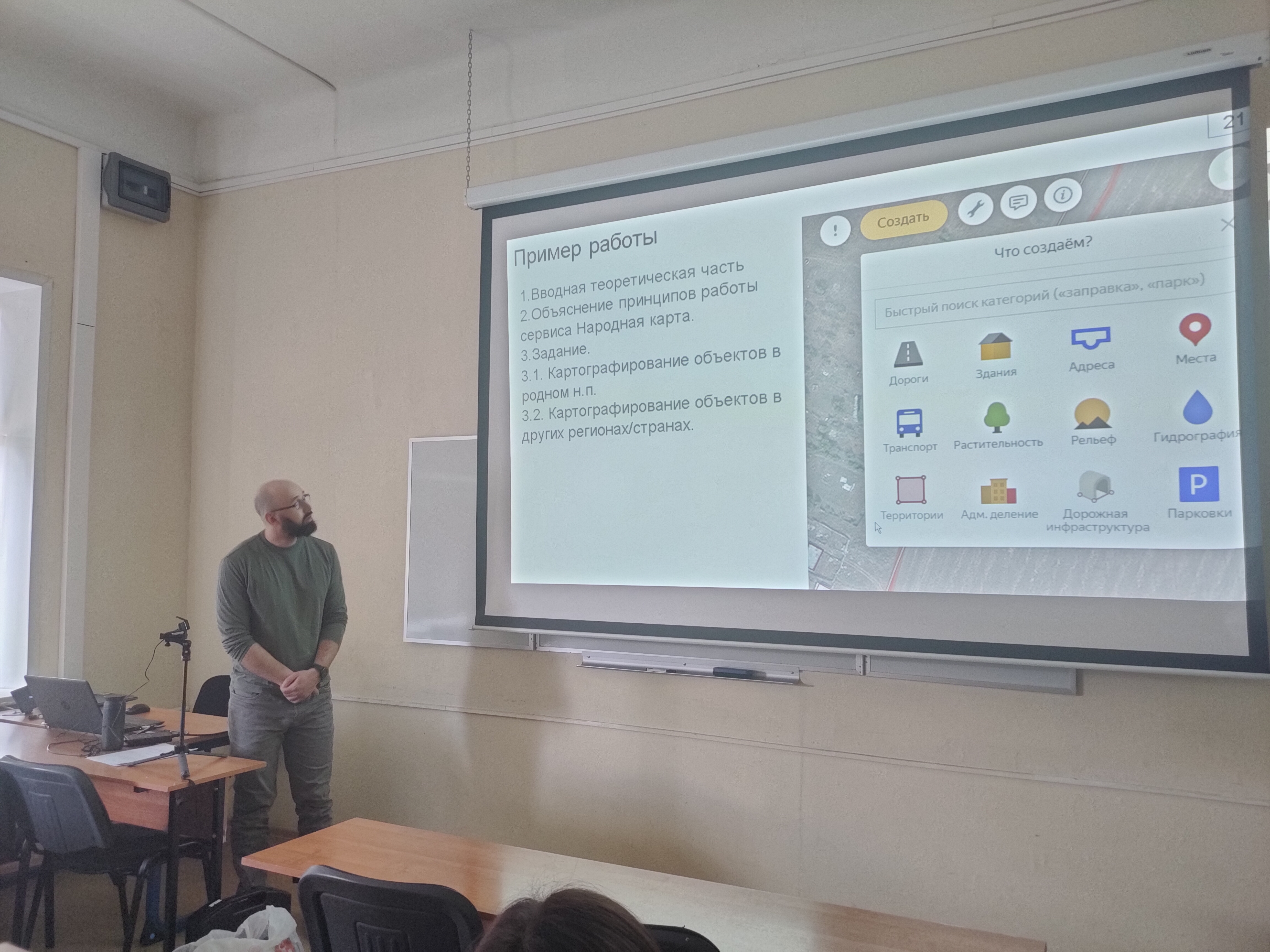
Nikolay Zolotov spoke about the application of geographic information systems in the school geography course. The use of GIS in teaching helps to develop students' skills in working with modern technologies, develops spatial thinking and the ability to analyze geographical information. The speaker proposed a variant of interaction of schoolchildren with GIS, when they are offered to draw objects on the “Yandex People's Map”. This is a service that allows users to draw and refine the map on their own. Pupils can be offered to choose a settlement they know well and check whether all objects are mapped: houses, addresses, monuments, roads, sports grounds, playgrounds, paths, school entrances, lawns. And if some objects are missing, ask them to add them to the map.
Nikita Medvedev finalized the event by talking about modern solutions for school geography using the FlexGIS platform. The main goal of FlexGIS is the transition from paper atlases and wall maps to teaching geography through an interactive cartographic portal. The platform is an interactive atlas and allows flexible management of data on the map by turning layers on and off, allowing students see only the information they need. All objects on the map are accompanied by descriptions, photos and videos. Teachers are presented with ready-made, verified content in an easy-to-deliver form. Pupils find it easier to memorize the lesson material thanks to the interactive form of information.
The conference participants noted that the introduction of digital technologies requires teachers not only to master new tools, but also to change their approach to teaching. It is necessary to develop skills in working with digital resources, to develop new methods and forms of teaching, as well as to take into account the individual characteristics of students. Participants expressed confidence that the introduction of digital technologies will improve the quality of geography education.
- About
- About
- Key Figures & Facts
- Sustainability at HSE University
- Faculties & Departments
- International Partnerships
- Faculty & Staff
- HSE Buildings
- HSE University for Persons with Disabilities
- Public Enquiries
- Studies
- Admissions
- Programme Catalogue
- Undergraduate
- Graduate
- Exchange Programmes
- Summer Schools
- Semester in Moscow
- Business Internship
- © HSE University 1993–2025 Contacts Copyright Privacy Policy Site Map
- Edit


