On January 27-29, 2023, the International Conference «Machine Intelligence for GeoAnalytics and Remote Sensing» (MIGARS) Was Held
The key organizer was the IEEE international engineering society. The purpose of the event is to create a communication platform for representatives of dynamically developing high-tech branches of science. Despite the event was held for the first time, it was attended by academia and business from two dozen countries.

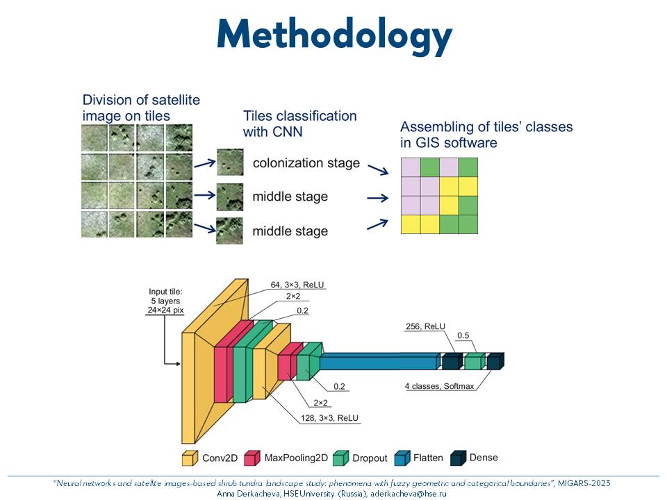
Anna Derkacheva, the researcher of the HSE International Laboratory of Landscape Ecology, presented a research actually carried out jointly with Russian and American colleagues. The presentation entitled ŌĆ£Neural networks and satellite images-based shrub tundra landscape study: phenomena with fuzzy geometric and categorical boundariesŌĆØ was devoted to the use of convolutional neural networks (CNN) to map the process of tundra shrubification using high-resolution satellite images. Shrubification is one of the most noticeable and widely observed trends in the changing Arctic nature across both continents, widely associated with the climate change. Usually, its investigation relies on visual mapping, which is very labor-intensive, time-consuming and possible only in small areas. The use of deep machine learning methods provides a possibility to solve this problem at a significantly higher speed with acceptable accuracy. This unlocks new opportunities for large cover mapping and dynamics tracking to study environmental factors that drive the shrubification. The study on the driving factors, realised with use of CNN-based mapping, is planned to be published in an "A"-list journal this year. The technical details on the image processing will soon be available in IEEE Xplore peer-reviewed e-library.
