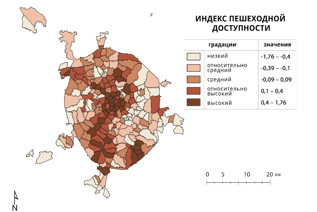
A Map of Moscow's Pedestrian Accessibility Has Been Created
Experts from the Higher School of Economics and Lomonosov Moscow State University studied data on the pedestrian accessibility of Moscow

The study was conducted under the management of Natalya Shartova, a leading researcher at the International Laboratory of Landscape Ecology at the Higher School of Economics, and is based on the use of open data. The results of the study show that accessibility for pedestrians in Moscow is heterogeneous in different areas of the city. For example, the central and southwestern districts have higher accessibility, while the eastern and southeastern suburbs are less accessible to pedestrians. These differences are explained by factors such as population density, the number of intersections and access to green areas. The study also found a link between pedestrian convenience and the social structure of the city, where higher accessibility is associated with areas of higher social status.
This study is the first in which the pedestrian accessibility index is adapted for Russia.
The study was published in the journal «Cities»: https://www.sciencedirect.com/science/article/abs/pii/S0264275123002810
