- A
- A
- A
- ABC
- ABC
- ABC
- А
- А
- А
- А
- А

Geography of Global Changes and Geoinformation Technology
Spatial Data and Applied Geoanalytics
Low Carbon Development
Ari G., Liu X., Jiang L. et al.
Ecological Indicators. 2026. Vol. 191.
Romanenkov V. A., Meshalkina J., Gorbacheva A. et al.
In bk.: Advances in Soil Science for Sustainable Landscapes. Springer, 2026. P. 651-663.
Shabanov N., Kuricheva O., Kurbatova J. et al.
Department of Economics Ca’ Foscari University of Venice. Working Papers SSRN. Social Science Research Network (SSRN), 2026

From Archival Maps to Geoinformation Technologies: Second-Year Students' Undertake Field Practice at Sochut Dendropark
The main goal of the field practice was to analyze the structure and dynamics of natural-territorial complexes based on archival and modern spatial data. The students mapped the current state of the arboretum's forest cover and the adjacent territory, identified the dynamics of the upper forest boundary, and created a three-dimensional digital representation of the site.
Andrei Medvedev, Associate Professor of the Faculty of Geography and Geoinformation Technologies and curator of the Geoinformation Technology and Spatial Modeling track, and Bashir Kuramagomedov, Senior Lecturer, organized the practice, with consulting support from Arseny Kudikov, Research Fellow at the Institute of Geography of the Russian Academy of Sciences.


The fieldwork was preceded by a preparatory stage in Moscow during which the students analyzed and prepared a spatial database. It included topographic maps from the late 19th and mid-20th centuries, archival Corona satellite imagery from 1971 and 1983, aerial photographs from 1974, and modern high-resolution PlanetScope satellite imagery. Based on the modern satellite imagery, the team compiled preliminary interpretation schemes to plan the fieldwork.
During the field routes, the students applied various geoinformation technologies and remote sensing methods:
• Collection of high-resolution aerial data: conducting aerial photography and photogrammetric processing for the rapid acquisition of high-resolution digital terrain models and orthophotomaps, using GNSS geodetic satellite receivers to improve accuracy
• Laser scanning: working with terrestrial LiDAR to collect three-dimensional point clouds. This enabled the automation of biomass calculation and the creation of ‘digital twins’ of the forest structure within the arboretum
• Satellite information analysis: interpretation of high-resolution PlanetScope satellite imagery to identify tree species by their spectral characteristics


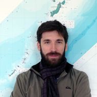
curator of the Geoinformation Technology and Spatial Modeling track
'It is very important that students can take the knowledge and skills acquired in class and apply them in field conditions. The practical use of modern equipment for spatial data collection, including terrestrial scanning and aerial survey tools, provides unique experience that students can apply in their future professional activities. Field routes and ground verification of remote sensing data processing results provide reliable information for mapping natural-territorial complexes. As part of the practice, students complete the full cycle of spatial data collection, processing, analysis, and visualisation to solve specific research tasks.’
The outcome of this field practice was a scientific report, a spatial database, and cartographic materials compiled for the territory for the first time. The materials obtained represent a unique spatial dataset containing 2D and 3D information on the qualitative and quantitative characteristics of the forest cover. It was even possible to analyze the state of the tree layer of vegetation at the level of individual trees within the arboretum.
Artem Nikitin
second-year student of the Geoinformation Technology and Spatial Modeling track
‘It is often said that field practices are the most memorable periods of study for students of geography faculties, and ours was no exception. The fieldwork of the Geoinformation Technology and Spatial Modeling track truly matches its profile and is also an excellent way to start studying this subject. Conducting the practice in mountainous terrain in the forests of the Stepanavan Dendropark allowed us to immerse ourselves in unfamiliar working conditions and learn the fundamentals of field aerial photography and working with LiDAR. We studied plant communities in various parts of the arboretum and at different elevations, which allowed us to get acquainted with altitudinal zonation firsthand. Experience, team cohesion, blisters, and knowledge of how resilient we are—we got it all from the second-year field practice.’
Vsevolod Vladimirov
second-year student of the Geoinformation Technology and Spatial Modeling track
‘During the second-year practice, I worked with terrestrial LiDAR for the first time and saw how such surveying is conducted not in theory but in real field conditions. As a result, I generated and processed a high-resolution point cloud, which ultimately enabled me to create a complete three-dimensional model of the territory. The stage of combining data from different sources—from UAVs and terrestrial LiDAR—proved to be especially interesting. The practice helped me better understand how modern surveying methods are applied to environmental studies, as well as gain unique experience working with equipment and data.’